If you are at the sandheads light station, and you head towards the next red can out to sea from it, you are skirting the boundary, any turn to the left, especially if you pass the large lighthouse west of the sandheads is most definitely part of what we refer to as the banana, 29 - 9 and 29 - 6.
If DFO were checking people and they weren't ticketing you were telling you to leave, I'm guessing their mandate for the day was to check for barbed hooks and Sockeye.
The reason it no longer says that it's closed to salmon fishing is because they opened it to pinks.
If you check the regs rather than looking for a specific notice, you will see that 29.9 and 29-6 are both open to pinks but not to Chinook.
I have fished in the legal area off of the coal port in the past, but it's actually out quite far, past the shipping channels.
As for "knowing" that you're legal, do you mean that you checked the GPS location against the points on the map? Most people are surprised at the direction you have to go from the Sandheads light station to remain in 29-4, if I were to describe the course I would say that I was heading towards active pass, not towards the coal port.
Once you head out several miles you can turn towards the San Juan Islands, but you would find your bearing to be well west of the coal port.
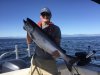
In the image below you can see the intersection of 29 3, 4, 9, 10.
That is the sandheads light station. From there is a line which goes south towards 29-6 before it turns slightly to the east. The point where it turns is the other large lighthouse (S0). From that lighthouse you have to head south rather than Southeast along the Shelf. There is a large area where a lot of people think it is legal, but you're actually in area 29 - 6.
I'm suggesting that maybe it's possible people are wrong: they think that they're legal and they're actually in 29-6


")