2023 OFFISHALL Vancouver-Howe Sound-Sechelt Reports Thread

Status
Not open for further replies.
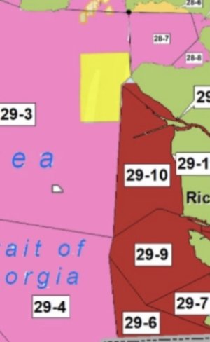
Yeah 29-3 to 29-5 is open…. Except the massive portion east of Shah to Gower. So it’s basically closed except near Thrasher.
Or else we’d all be at Sand Heads now…. They need to redraw the sub area boundaries this is really dumb.
Yes, Sandheads would be foaming.

28-6 is all there is for our area today.
 
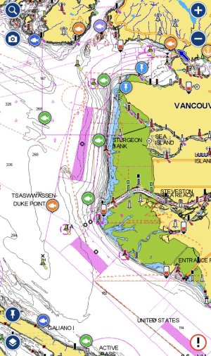
29 - 10, 9, 7 and 6 cover sandheads however. I'm pretty sure the restrictions are the north arm and point grey of 29 - 3 but I need to definitely look at the map in hard copy but it does contradict what the restrictions say. What a circus.
No those are all the shallows (29-6 to 10) map is deceiving. Overlay over your charts you’ll see, fishable area is in 29-3 to 29-5.
 

Attachments

  • DDFE8807-1FAE-409B-8F4D-02A1C40185DE.jpeg
    DDFE8807-1FAE-409B-8F4D-02A1C40185DE.jpeg
    306.7 KB · Views: 98
  • 7B2AAC4E-4913-472B-BBE7-05FDF0E5E588.jpeg
    7B2AAC4E-4913-472B-BBE7-05FDF0E5E588.jpeg
    70.2 KB · Views: 97
Agreed, those are all the shallows, got all giddy and over my skis. Anyway I'm fine to point my boat north and get to keep it after too. Let the bumper boat games off west van commence!
 
and more of thrasher opens up today
in Orange on the map.
Agreed, those are all the shallows, got all giddy and over my skis. Anyway I'm fine to point my boat north and get to keep it after too. Let the bumper boat games off west van commence!
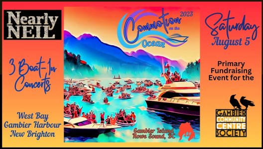
There is a Nearly Neil on the water concert there tomorrow at West Bay in the afternoon. Boat flotillas will be there. Put your bumpers out.


Screenshot 2023-08-01 111759.jpeg
 
Same as last years regs. A total Cluster *****....Imagine all the best fishermen in Vancouver are on this website and can't figure things out. What's that say about the way regs are communicated.
Exactly what I was thinking.
 
Same as last years regs. A total Cluster *****....Imagine all the best fishermen in Vancouver are on this website and can't figure things out. What's that say about the way regs are communicated.

There is simply no way this is pointed at me hahaha! Honestly, I have been instructed even with a casual and almost worthless legal opinion that isn't worth the johnny walker soaked bar napkin it was inked on that the "RESTRICTIONS" are the bottom line. Not that I want to test that opinion, so I will always defer to the map or lowest common denominator. It is stunning how they make it so complex which should be something so easy to publish. Where's CHATgpt when you need it...
 
It would be nice if they had an interactive map with all the BC fishing areas and all you had to do is touch the area on your screen and all the current restrictions for a particulars species would come up. I am at this location. Touch. Ok, that's what I can catch and keep. The problem is trying to decipher what restrictions apply to what area. Maybe eventually it will be incorporated into the chart plotter. At least my Garmin has many of the closed RCA and speed restriction areas marked.
 
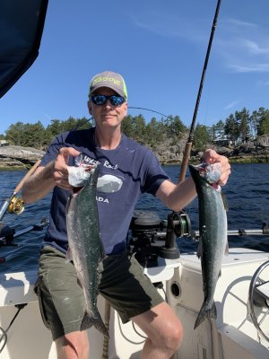
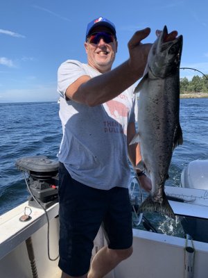
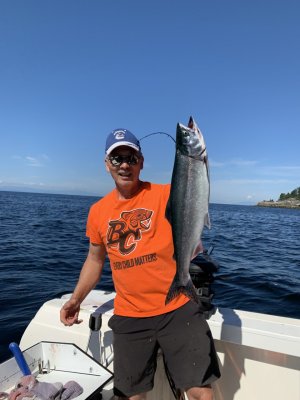
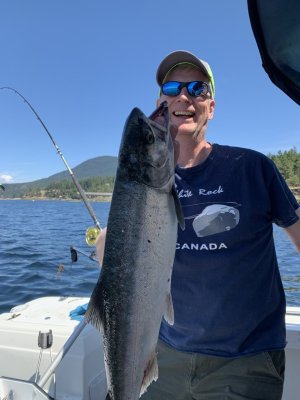
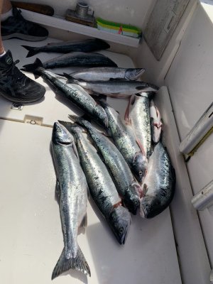
As for reports I’m just home with our limits of Pinks. Tried to book a Coho to no avail today. Fun times though with no time to relax. Non stop hits out there
 

Attachments

  • 5B8178D4-58CD-45C1-BB0E-D0B75C4F64BB.jpeg
    5B8178D4-58CD-45C1-BB0E-D0B75C4F64BB.jpeg
    225.5 KB · Views: 139
  • DC5D2601-E96E-40F8-889E-13624358D509.jpeg
    DC5D2601-E96E-40F8-889E-13624358D509.jpeg
    190.1 KB · Views: 137
  • E45ACC8A-D1EC-4CE6-9200-8FC1EB14530A.jpeg
    E45ACC8A-D1EC-4CE6-9200-8FC1EB14530A.jpeg
    157.2 KB · Views: 136
  • B65054BC-58AB-4F92-A4A1-D21A856E1D54.jpeg
    B65054BC-58AB-4F92-A4A1-D21A856E1D54.jpeg
    164.6 KB · Views: 149
  • 2F3AD384-EA7A-4BFD-9DFD-F4E80DD8D248.jpeg
    2F3AD384-EA7A-4BFD-9DFD-F4E80DD8D248.jpeg
    227.3 KB · Views: 149
  • FDE76CB4-4564-4236-BBC9-43CE111B3893.jpeg
    FDE76CB4-4564-4236-BBC9-43CE111B3893.jpeg
    190.8 KB · Views: 150
It would be nice if they had an interactive map with all the BC fishing areas and all you had to do is touch the area on your screen and all the current restrictions for a particulars species would come up. I am at this location. Touch. Ok, that's what I can catch and keep. The problem is trying to decipher what restrictions apply to what area. Maybe eventually it will be incorporated into the chart plotter. At least my Garmin has many of the closed RCA and speed restriction areas marked.
That absolutely could be done using GIS software namely Arc GIS Online. I'm sure in other jurisdictions its been done for sportfishing. It would be soo much clearer for the average person that can't decipher DFOs mess of a website.
 
in Orange on the map.

There is a Nearly Neil on the water concert there tomorrow at West Bay in the afternoon. Boat flotillas will be there. Put your bumpers out.


View attachment 95556
in Orange on the map.

There is a Nearly Neil on the water concert there tomorrow at West Bay in the afternoon. Boat flotillas will be there. Put your bumpers out.


View attachment 95556
The concert is Saturday, it is great family fun and is the principal fund-raiser for our local community centre on Gambier, which is the hub of our little community. If you come, please bring some cash for a donation for the community centre. I am the donation boat (“Missfire”, a 17’ Hourston) and will have a sign out to that effect. Please say “hi”, would love to see some members out.
 
Fished Gower to Roberts Creek today. Kept two nice springs, one small clipped coho and a pink that was a bleeder. Released some pinks and countless unclipped coho - I lost track of how many. Unfortunately, not many clipped coho in the mix today, but a great morning nonetheless. Nice and calm and lots of action. Huge anchovy balls at Roberts Creek. 35-45’, blue scale/chrome spoon above a dummy did a bit better than the white hootchie today.
 
That absolutely could be done using GIS software namely Arc GIS Online. I'm sure in other jurisdictions its been done for sportfishing. It would be soo much clearer for the average person that can't decipher DFOs mess of a website.
This is an app I’ve wanted to develop for years.. but don’t like the idea of interpreting DFO regs and turning into an interactive map as you have to really understand what they are saying in order to tell others how to behave.
 
This is an app I’ve wanted to develop for years.. but don’t like the idea of interpreting DFO regs and turning into an interactive map as you have to really understand what they are saying in order to tell others how to behave.
The FishingBC App does this - Sport Fishing Institute's app is available for Apple and Android. And it's tracking to be a legal license as well, no more paper needed. You can record your Chinook, Ling, and Hali all on the platform and it will be legal in the near future.

Plus you have location specific regulations for the various species you are targeting.
 
Status
Not open for further replies.
Back
Top