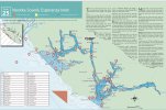
Heres another map you can add and use. As far as more detail goes it’s kinda hard for people to do. It’s a big area and fish aren’t always on the same spot. It’s up to the individual to do your own homework. Use that map you have and use it against google maps, download the Navionics app and use the charts on there against the maps you’ve been provided. Read the posts on here and cross reference the names people use to get acquainted with the area. When you get to the area talk to people, eves drop on conversations to get a feel for where the bites are happening. Go back to your maps and mark the spots. When you get to the spots there will be boats there, pay attention to what they are doing, get in line and follow their tacks. In my boat I have printed off maps of areas that interest me. Use the Navionics app to get GPS coordinates on the spots listed on these maps so you can put them in and head to those spots. Go back and read old posts on this site and other sites. On this site there is years of historic saltwater reports to read through. Tons of info in them. Pay attention to the dates people are posting, where, what. The info is out there you just have to do some digging.

