Haida Gwaii

Sharphooks

Well-Known Member
I’ve wanted to go that part of the Pacific for decades. I finally have a boat that I’d feel reasonably safe going across Hecate Strait.

Has anybody on this forum done that trip? I met a guy this summer who went across from Otter Pass (just North of the Estevan Group) in a 40 foot cabin cruiser. They made the trip just to see friends then came back so not much info from his trip

I’d want to stay and explore but I haven’t been able to find much information on line for non-guided or non-tour trips.

Can anybody recommend resources on taking a trip like that? I had a guy tell me today you have to apply for permission—-is that true?

thanks for any comments from the SFBC brain trust
I’ve been across the Hecate lots I cross from Rupert to Charlotte city I believe it’s 93 miles
You don’t need any sort of permission
Big tides open water lots of crab traps always try and plan my trips with some leeway either side to have the easiest crossing
Was blowing 20 when I went across this year and took about 5.5 hrs went a bit further south to ride the trough so I wasn’t pounding the whole way you can cross over the bar so you don’t have to go all the way to lawn pt and back down I can send you the route I take if you’d like
Coming back was glass calm and was 2.5 hrs dock to dock
Rupert to Masset is around 65 miles or something like that but your in Chatham sound till south Dundas then you can run over in deeper water that the waves don’t seem to stack up as bad
I’ll be heading over again next year around the 26 of august
Any questions feel free to pm me or ask here so you can get a few opinions!
 
I’ve wanted to go that part of the Pacific for decades. I finally have a boat that I’d feel reasonably safe going across Hecate Strait.

Has anybody on this forum done that trip? I met a guy this summer who went across from Otter Pass (just North of the Estevan Group) in a 40 foot cabin cruiser. They made the trip just to see friends then came back so not much info from his trip

I’d want to stay and explore but I haven’t been able to find much information on line for non-guided or non-tour trips.

Can anybody recommend resources on taking a trip like that? I had a guy tell me today you have to apply for permission—-is that true?

thanks for any comments from the SFBC brain trust
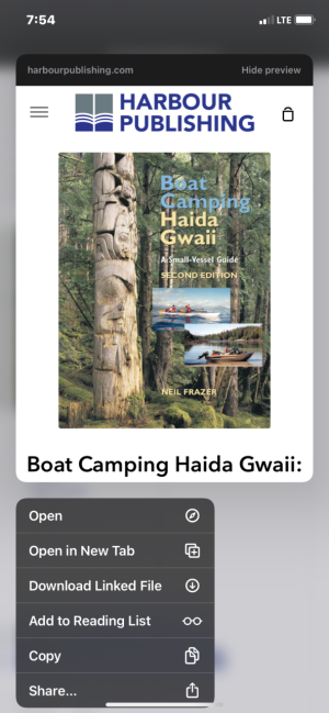
Not sure if you have seen this book. I guy I fish with knows the author. He has some pretty exciting stories from the author. I haven’t had a chance to read it yet.
 

Attachments

  • 2BC96C64-5AE0-41A2-8CE1-66547A8989B9.png
    2BC96C64-5AE0-41A2-8CE1-66547A8989B9.png
    586.2 KB · Views: 56
Not sure if you have seen this book. I guy I fish with knows the author. He has some pretty exciting stories from the author. I haven’t had a chance to read it yet.

I just ordered that book this week! And thanks for your comments, Bryce...much appreciated
 

Hey BC Coastal PIlot—-very helpful to provide that URL: So I’m curious: most smaller sport fishing vessels do not have adequate real estate to carry and properly store paper charts to cover all the nav spots they might transit, much less adequate real estate to spread them out and look at them

I treaded very lightly this summer going in and out of bays and rock piles in Beauchemin Channel, having no idea how accurate the charts were in my MFD’S

Looking at the sailing directions for areas in Haida Gwaii I’m thinking the nav charts loaded in any given MFD would be even more sketchy. Would you recommend getting paper charts as the primary source of Nav information?

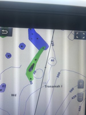
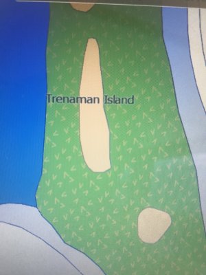
I remember seeing this conflict on C-map and Navionics:


967BDF35-DDA5-4297-A957-A905C09B89E0.jpeg970CDD76-96E7-4B12-A18C-6DB222FC5AE6.jpeg

It wasn’t just spelling differences: I saw reefs in Navionics that were not properly placed relative to the bathymetrics on the chart and what I was seeing on my sonar

Makes me wonder how many other discrepancies you could find in an even remoter area like Haida Gwaii with all those countless reef, rocks and islands

Curious to hear your comments on that
 
Hey BC Coastal PIlot—-very helpful to provide that URL: So I’m curious: most smaller sport fishing vessels do not have adequate real estate to carry and properly store paper charts to cover all the nav spots they might transit, much less adequate real estate to spread them out and look at them

I treaded very lightly this summer going in and out of bays and rock piles in Beauchemin Channel, having no idea how accurate the charts were in my MFD’S

Looking at the sailing directions for areas in Haida Gwaii I’m thinking the nav charts loaded in any given MFD would be even more sketchy. Would you recommend getting paper charts as the primary source of Nav information?

I remember seeing this conflict on C-map and Navionics:


View attachment 85104View attachment 85105

It wasn’t just spelling differences: I saw reefs in Navionics that were not properly placed relative to the bathymetrics on the chart and what I was seeing on my sonar

Makes me wonder how many other discrepancies you could find in an even remoter area like Haida Gwaii with all those countless reef, rocks and islands

Curious to hear your comments on that
Good question.
I run Official Raster charts from CHS on Coastal Explorer for my personal use on a windows based toughbook.
I often see missing or incorrectly interpreted soundings on Navionics and other app type stuff including Garmin, Raymarine....furuno etc. It's always good to have a chart but with technology now it will soon all be obsolete and only available by download. It is an acceptable practice now to have some of these docs available electronically on the vessel.
When I was studying for pilots I referred to Navionics occasionally but just as you pointed out there are just too many discrepancies. That being said I believe it's only as good as the guy that interpreted the data to the new chart and he may not have seen the importance of accurate data in a particular area. The best data available is direct from CHS, that book of sailing directions for example. As with most things, you get what you pay for, I pay particular attention to contour lines, check out the difference sometime from the actual survey chart from CHS to a low end Vector chart. Feel free to DM me, we're here to help.
 
I’ve been across the Hecate lots I cross from Rupert to Charlotte city I believe it’s 93 miles
You don’t need any sort of permission
Big tides open water lots of crab traps always try and plan my trips with some leeway either side to have the easiest crossing
Was blowing 20 when I went across this year and took about 5.5 hrs went a bit further south to ride the trough so I wasn’t pounding the whole way you can cross over the bar so you don’t have to go all the way to lawn pt and back down I can send you the route I take if you’d like
Coming back was glass calm and was 2.5 hrs dock to dock
Rupert to Masset is around 65 miles or something like that but your in Chatham sound till south Dundas then you can run over in deeper water that the waves don’t seem to stack up as bad
I’ll be heading over again next year around the 26 of august
Any questions feel free to pm me or ask here so you can get a few opinions!
How has the late august and early September salmon and halibut fishing been? Might join you with my boat for the crossing next year, or the year after, a man can dream right?
 
Be aware that if you wanted to make landfall on Haida Gwaii in the National Park Reserve, you'd require advance permission and an orientation, and the number of visiting boats is strictly limited. Since you'll want to fish the West Coast, heading for Masset or Skidegate Inlet rather than Gwaii Haanas is the natural choice in any case. Be aware that there are tidal differences of more than 25 feet on Hecate Strait, but only around 10 feet on the West Coast, and wind against tide or tide against tide can produce sudden changes in sea conditions over and above what the unpredictable weather stirs up, often with little notice.

Landing in Masset requires a long run across the top of Graham Island, which is very exposed to northerly winds, then crossing a bar with heavy currents and tidal action, to get into Masset Inlet and the port of Masset. Entering Skidegate Inlet is easier, but it's best to follow the route the ferry does as you come in, because the Sandspit Bar and the waters east of it feature lots of uncharted glacial erratics and shallow spots. The ferry comes inshore a few miles north of the north end of the bar, then runs parallel to the coast and into the inlet.

From Daajing Giids (DG), the former Queen Charlotte City, the channel to the West Coast is well marked, but it's impassable on very low tides, and it's not uncommon for the unwary to unexpectedly dig for clams with their props at other times. We watched a guy do just that earlier this month. The situation isn't helped by the fact that the channel markers seem to have been set up in relation to the dominant current direction, rather than being sanely oriented to returning to home port in Sandspit or DG. That means it's "red left returning" when you're coming back to harbor.

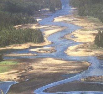
The attached photo shows a portion of the East Narrows that links the two coasts of Haida Gwaii, at an extremely low tide. In the situation shown, you'd have less than two feet of water under your keel in several spots.


East Narrows-Meegan Photo.jpg
 
The couple of outings I've had in Haida Gwaii have been out of Skidegate heading to the west coast via the narrows shown in the above post. My buddy is a born and raised local and he runs that section quite fast, makes it into Boat Slalom. But very aware of the state of tide and current before he gets there. It's a spectacular piece of water and adds to the experience before you even begin fishing.

@Karlo has a lot of good info for the OP. Read carefully. Hecate Strait is a serious place. Big exposure, shallow water, large tidal range can all combine to make a lot of trouble.
 
Be aware that if you wanted to make landfall on Haida Gwaii in the National Park Reserve, you'd require advance permission and an orientation, and the number of visiting boats is strictly limited. Since you'll want to fish the West Coast, heading for Masset or Skidegate Inlet rather than Gwaii Haanas is the natural choice in any case. Be aware that there are tidal differences of more than 25 feet on Hecate Strait, but only around 10 feet on the West Coast, and wind against tide or tide against tide can produce sudden changes in sea conditions over and above what the unpredictable weather stirs up, often with little notice.

Landing in Masset requires a long run across the top of Graham Island, which is very exposed to northerly winds, then crossing a bar with heavy currents and tidal action, to get into Masset Inlet and the port of Masset. Entering Skidegate Inlet is easier, but it's best to follow the route the ferry does as you come in, because the Sandspit Bar and the waters east of it feature lots of uncharted glacial erratics and shallow spots. The ferry comes inshore a few miles north of the north end of the bar, then runs parallel to the coast and into the inlet.

From Daajing Giids (DG), the former Queen Charlotte City, the channel to the West Coast is well marked, but it's impassable on very low tides, and it's not uncommon for the unwary to unexpectedly dig for clams with their props at other times. We watched a guy do just that earlier this month. The situation isn't helped by the fact that the channel markers seem to have been set up in relation to the dominant current direction, rather than being sanely oriented to returning to home port in Sandspit or DG. That means it's "red left returning" when you're coming back to harbor.

The attached photo shows a portion of the East Narrows that links the two coasts of Haida Gwaii, at an extremely low tide. In the situation shown, you'd have less than two feet of water under your keel in several spots.


View attachment 85293
When you look at this photo it's hard to believe I used to take my Seine boat thru there
 
A trip to Haida Gwai has been on my dream list for years, but trying to push it up and make it happen next year! If fishing on the west side, are there any fueling (gasoline) options? Seems like that is a big limiting factor.
 
A trip to Haida Gwai has been on my dream list for years, but trying to push it up and make it happen next year! If fishing on the west side, are there any fueling (gasoline) options? Seems like that is a big limiting factor.
No fuel on the west side
 
There's got be some salmon in Juan Perez and Skincuttle. There are for sure halibut not far out in Hecate Str. and some delicious creatures up inside the inlets in low tide shoreline rockpiles. Beautiful area.
 
You only need permission to enter Gwaii Haanas, the park on South Moresby. Everything else is the same as the rest of the coast.

I've done a few trips along the west side over the years, between Frederick Island and Sunday Inlet. The Boat Camping Haida Gwaii book is a great resource. I liked basing out of Sandspit, the marina is great, showers, water, sewer, fuel. It is on the opposite end of town from the store though. Make sure to confirm the fuel dock hours. It's open when they say it will be.

As mentioned, if you want to be cautious, stay close to high tide for the narrows. You should be fine higher than a 5' tide, but don't quote me on that. I've done it on a 1.5' tide in a small zodiac, almost had to get out and drag the boat through one section, was down to about 4" of water. If you are on plane, you can run it regardless of what the current is doing, provided you have enough depth. It's fast, but not an issue for a planing sport boat.

You used to be able to contact parks ahead of time and get an orientation package sent to you for entry into Gwaii Haanas if you let them know you are arriving directly into the park by boat from off island. Otherwise you had to attend an in person orientation in Queen Charlotte. It's been a couple years since I did it, I imagine they still offer that option.

If you are running up from the south coast or out of Kitimat, I'd personally get fuel in Hartley Bay and cross to Sandspit around the south end of Banks. Be careful, that fuel dock is notorious for not being open when they say they will be. Going into Masset, there isn't as much to explore locally. Depends what you want to see really. I like the west side of Moresby, so made more sense to run from Sandspit.

I've seen the navionics charts off by 150m on the north coast. GPS putting the boat in the middle of an island that's 100m away. The CHS charts often won't have the same level of detail that some of the new electronic charts have. Depending on what you're doing, both are going to be useless in some areas. Take Van Inlet or Skelu Bay for example, they just haven't been surveyed. I have always used my chart plotter, with navionics on a phone as backup, but that's my risk tolerance. If you're exploring in all the various bays, inlets and island, the depth sounder and caution are the best tools in my experience. The charts are key, but they are no substitute for watching the water and depth.

Here are some photos from one of the trips. Lots of cool places if you have time and want to get out to poke around.

 
Back
Top