SpringVelocity
Crew Member
I couldn't upload entire document I just posted a few highlights of what is being discussed. Important these maps are not the final options but you see where the department is heading with this which is very disturbing.
The entire document has been sent out the the local SFAB group members from each area. DFO is asking for input by mid Feb.
I honestly was shocked it was being proposed, and pushed again. Some of these at discussion as option 2 will cause a lot of harm to our fisheries.
Here are the maps:
Mainland
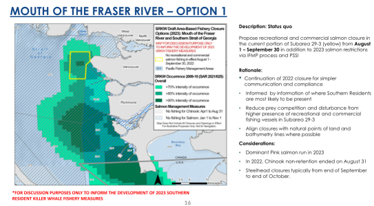
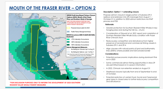
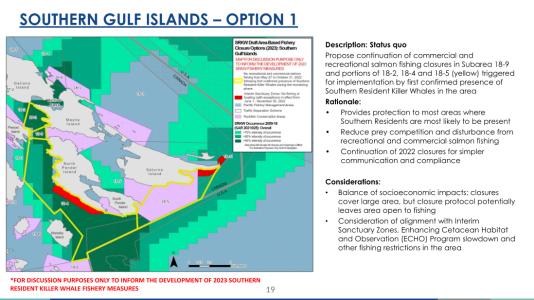
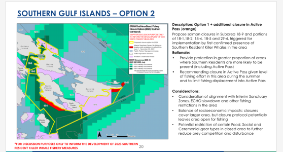
Gulf Islands/Pender Island Area
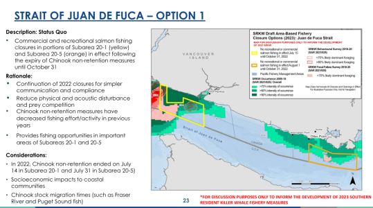
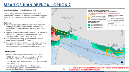
Port Refrew and Sooke
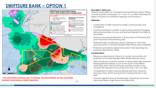
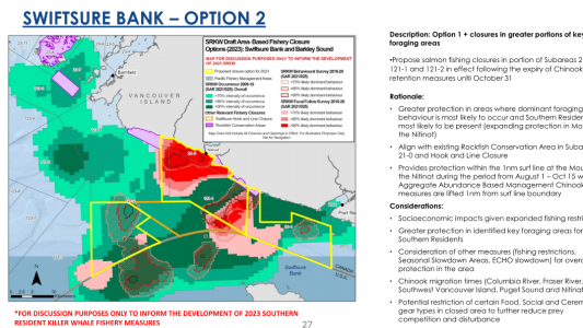
Port Renfrew/Swiftsure bank
The entire document has been sent out the the local SFAB group members from each area. DFO is asking for input by mid Feb.
I honestly was shocked it was being proposed, and pushed again. Some of these at discussion as option 2 will cause a lot of harm to our fisheries.
Here are the maps:
Mainland


Gulf Islands/Pender Island Area


Port Refrew and Sooke


Port Renfrew/Swiftsure bank


Last edited:

