Hi to Smileys Crib
I couldn't find the info. you need on the forum so here is my 2 cents worth on Bella Coola to Bella Bella.
First off, get a tide chart. It is difficult to launch a 20+ ft. boat at the Bella Coola marina if the tide is below about 3 ft. Look for a morning or evening departure as the first part of the trip seems to always be rough in the afternoon.
(please note, spelling is not my strong suite) Bella Coola to Mechachie Nose turn right into Laboucherie Channel around the nose. (20-30 minutes @ 22-25 knts.) Take Laboucherie to the Dean (also known as the upper Fisher) and turn left to travel down (SW)the Dean\Fisher. At this point you will have spent about 50 minutes to 1 hr. On the north side of your turn towards SW is Eucott Hotsprings bay. It is a good hide-out if the wind comes up.
So now you are travelling down the Fisher past MacKenzie Rock, many inlets to the north, and King Island on your left all the way. Jenny Inlet is on the left into King Island. You will pass by Cousins Inlet on your right that goes into Ocean Falls. (you could take a look but Ocean Falls is about a 30 min. detour each way) Look for Rattenbury Point on the chart. Once you have passed Rattenbury look down the channel and on the right side you will see a white marker light. That is the entrance to the Gunboat Pass. Go around the point and up about 150-250 yds. is another marker on your left. You turn left there and you are in the gunboat. WATCH FOR ROCKS and use your chart and\or GPS plotter. Once you have navigated through the narrower part of the gunboat it opens up and you will see some nav. aids and marks on rocks as you head W. Look for a light\white marker on the island at about your 11-12 o'clock position. You will need to turn left there. DO NOT CUT THE CORNER, THERE ARE ROCKS ON YOUR LEFT. From the left turn just follow the channel and make a right turn and about 20 seconds later you will see Shearwater and Denny Island. At your 2 o'clock position you will see the town of Bella Bella. Total travel time at 22-25 knts. is 2:30 hrs.
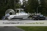
We first took this route in 1992 with a handful of charts, a handheld gps (no plotter) a tent, sleeping bags, coleman stove, and some beer using a late 60's flat bottomed 21 ft. Fiberform boat.
Hope this helps.
Den

