Sharphooks
Well-Known Member
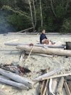
While my daughter was aboard, we hooked a few springs and coho, just enough to feel like there were some numbers around and just enough to have a BBQ spring on North Beach at Hakai....nice to have an entire beach to ourselves...the dog went nuts chasing birds in the surf while we gormandized and split a bottle wine
It was important to bring toys this year. When you have a passenger on your boat who can give or take a 12 hour marathon of going around in circles dragging a piece of bait over one fishing hole, the toys bring a level of sanity into the picture.
I sprung for an inflatable kayak this year——really a well-made unit that deflates to the size of a rolled up sleeping bag. But I wouldn’t want to have a fishing hook anywhere near it:
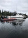
One day we concentrated on ling cod out of my inflatable raft. I hooked what I thought was a large stone. Huge weight, not the throbbing movement you’d expect from a fish. What came up from the depths had a head the size of a basketball. There was no way I was going to even try to get that into the boat. I rowed the raft back to the mothership and got the fish on the swim step. It was absolutely huge, pushing 40 lbs , maybe more. I don’t know how big those things get but it looked prehistoric with the huge snaggly teeth hung in a mouth large enough to inhale a human child in one quick grin
When my daughter flew out of Bella Bella in late July my fishing got serious. With my new Sea Sport and the huge travel range I have with a tank that holds just under 700 liters, I headed North to Nepean Sound. I love fishing off Banks and Pitt—-no people. I’ve never had red hot fishing in that area but I’ll always trade solitude and a true wilderness experience for numbers.
An anchorage on Pitt Island I’ve used over the years. Completely different beaches and rock formations Compared to Hakai
When I got to Hartley Bay to refuel there was a major deterioration in the weather ( for the first time of the trip). It blew from the Southeast which meant monsoon rains. It really was too bad because that’s such a lovely part of BC —-when the rain is going sideways, you just don’t want to be on the back deck of your boat. Navigating across Wright Sound at the mouth of McKay Reach it got downright nasty: 1 - 2 meter seas on the tide change. I thanked the Lord for finally having a bigger more stable boat so I didn’t have to get out the rosary beads like I did in year’s past with the smaller boats I had on this trip . The Sea Sport hull design is as good as it gets for big water and I felt safe with the twin Zukes cutting through that stuff. I usually steer clear of Barnard Harbor but I made an exception this year and went in there (with about 5 other boats) to wait out the blow.
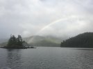
The next morning was still a bit gloomy but the wind had backed off. When I got out of Barnard Harbor this is what I saw. MOments like that make the change in weather patterns and the rain and wind that accompanied it worth the price of admission:
I found a few spots off Ashdown and the east side of Campania that had fish. For the first time of my salt chuck fishing career I decided to use a flasher. I found a break-away hiding in my gear box and matched it with a Skinny G. Yikes. There was about a one hour period I had during a high slack tide where I felt like I was back in my commie trolling days......fish after fish after fish. It was just a blur of Springs and coho. Nuts fishing. The springs weren’t big (8 - 12 lbs) and some of them (believe it or not) were fin-clipped hatch jobs, probably Columbia River or Salish Sea hatch origin. First time I’ve ever seen a fin-clipped spring anywhere in BC other then in the Bamfield/Ucluelet area. I heard from a friend in Shearwater that he’d also caught a few hatch springs off Denny Island in July. His comment: “this can’t be a good thing”....
So after circumnavigating Campania the weather became so stunningly gorgeous I decided to navigate Beauchemin Channel on the Pacific side of Aristazabal. I’ve wanted to make that move for the last decade but never had the weather (or the huevos) to take that route. This year I did.
It’s always interesting to me the physiological reaction that takes place when you make a nav decision that you know will leave you exposed....a tightening in the chest....the mouth goes dry....the breathing changes. While turning the Zukes to starboard at Oswald Point I mused on the literal translation of Beauchemin in English. Beautiful Path.....this had an immediate calming influence on my breathing
Yes, absolutely stunning scenery. Completely different seascape then the east side of Aristazabal (which you’d expect because the west side is completely exposed to the fury of the Pacific)
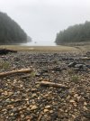
I finally got to explore Clifford and Weeteeam Bay . In Clifford I went looking for firewood to BBQ a coho. The dog was so thrilled to get off the boat she did a Shetland war dance on the beach
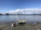
Most of the wood was still wet from the SE blow but we finally got the right fire going and got the fish done and I split the fish and a bottle of sake with the dog.....and not a moment too soon because it was a race with the tide
Going:
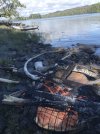
Going:
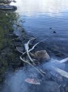
Gone:
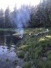
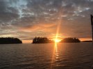
Spent a nice calm evening on the hook and ventured back out to Beautiful Path at dawn and got a nice morning shot of the Normansell Island group at sunrise
That morning the fog rolled in thick and heavy. I did a bit of agonizing on whether to do Prior Passage to get back into Laredo Sound or go clear around the bitter end of Aristazabal, taking Munro Island from the south.
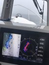
Based on my charts the Munro route had a maze of rocks and reefs to contend with. In pea-soup fog I got the chest-tightening going on and the dry mouth. I have two chart plotters on the boat, Furuno (with C-map) and Garmin (with Navionics). Both of the charts showed Prior Passage also as a serious rock garden and there was no way to visually see a clear depth profile. For some reason the charts made the passage look like mud flats! Add a bit of fog to the mix and you get that queasy feeling of exposure whichever decision you make.
But they called it a passage didn’t they? A passage is a passage isn’t it? . That was the thought process going on: Trying to justify safe passage when the charts were showing it might be sketchy.
Last edited:
